
Intro to Geospatial Data
By Dan Tonkovich

It’s not often that someone begins a blog post by admitting they’re unqualified to write about the topic, but here we are. I am not a geospatial data expert. There are professionals who spend their entire careers analyzing and manipulating geospatial data, many of them right here at the City of San Francisco.
That said, I’ve often found it’s occasionally easier to learn the basics from someone who isn’t an expert. After all, the math PhD isn’t always the best person to teach addition — they can’t imagine what it’s like to know so little about numbers.
So, from one non-expert to another, I’m going to explain the basics of geospatial data.
The Basics
Geospatial data is made up of three basic shapes: points, lines, and polygons. If your data doesn’t contain one of those shapes, it cannot be visualized on a map.
Point
A point is a single latitude and single longitude. An address could be expressed as a point and look like this:
POINT (-122.418727824 37.779332257):

Line
A line is two points that are connected. A street can be expressed as a line and might look like this:
LINESTRING (-122.418226581 37.778489117, -122.418598509 37.780260133)
Polygon
A polygon is a boundary or closed shape (multiple points connected together). Parcels are polygons.
Examples of Points, Lines, and Polygons
Points, lines, and polygons are used across the city for countless tasks. Here are some common examples you may come across (and a link to the Open Dataset if you want to explore further):
Point
Line
Polygon
Learn More
Read up on San Francisco Street Data: Understanding Street Level Data
Appendix
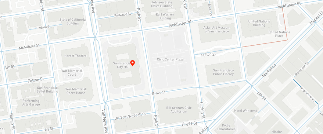
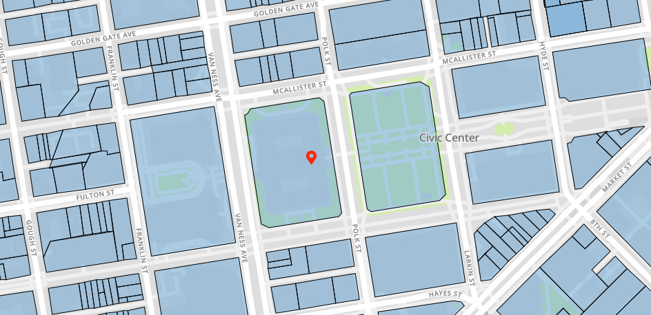
Here is what the city hall parcel polygon looks like:
MULTIPOLYGON (((-122.419596996 37.778474539, -122.419601245 37.778477425, -122.419605559 37.778480252, -122.419609932 37.778483019, -122.419614367 37.778485725, -122.41961886 37.778488369, -122.419623411 37.77849095, -122.419628019 37.778493469, -122.41963268 37.778495922, -122.419637394 37.77849831, -122.419642161 37.778500634, -122.419646978 37.77850289, -122.419651844 37.77850508, -122.419656756 37.778507202, -122.419661716 37.778509255, -122.419666719 37.778511239, -122.419671765 37.778513155, -122.419676853 37.778514999, -122.419681981 37.778516773, -122.419687147 37.778518476, -122.419692349 37.778520106, -122.419697586 37.778521665, -122.419702858 37.778523151, -122.41970816 37.778524563, -122.419716065 37.778526519, -122.419985168 37.779857717, -122.419979618 37.779861111, -122.419974146 37.779864579, -122.419968748 37.779868123, -122.419963429 37.779871742, -122.419958191 37.779875434, -122.419953036 37.779879198, -122.419947963 37.779883031, -122.419942976 37.779886935, -122.419938075 37.779890908, -122.419933262 37.779894947, -122.419928538 37.779899054, -122.419923907 37.779903224, -122.419919368 37.779907458, -122.419914922 37.779911755, -122.419910571 37.779916112, -122.419906316 37.779920529, -122.41990216 37.779925004, -122.419898102 37.779929537, -122.419894146 37.779934124, -122.419889288 37.779940001, -122.418819127 37.780076278, -122.418815495 37.780073512, -122.418811802 37.780070797, -122.418808049 37.780068132, -122.418804239 37.780065521, -122.418800373 37.780062963, -122.41879645 37.780060458, -122.418792473 37.780058008, -122.418788442 37.780055615, -122.41878436 37.780053276, -122.418780227 37.780050995, -122.418776043 37.780048772, -122.418771813 37.780046606, -122.418767535 37.7800445, -122.41876321 37.780042453, -122.418758843 37.780040467, -122.418754432 37.78003854, -122.41874998 37.780036676, -122.418741947 37.780033508, -122.418466192 37.778669303, -122.418469887 37.778666539, -122.418473521 37.778663723, -122.418477091 37.778660857, -122.418480597 37.778657943, -122.41848404 37.77865498, -122.418487417 37.77865197, -122.418490727 37.778648914, -122.41849397 37.778645813, -122.418497144 37.778642667, -122.418500247 37.778639477, -122.418503281 37.778636245, -122.418506242 37.778632972, -122.418509132 37.778629658, -122.418511948 37.778626304, -122.418514689 37.778622912, -122.418517357 37.778619482, -122.418519948 37.778616017, -122.418523337 37.778611262, -122.419596996 37.778474539)))